Here's the original Route 66 California area of the site. This section will be updated soon.
----------------------
UPDATE :
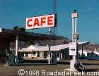
Photos of Ludlow and the Bagdad Cafe in Newberry Springs after the October
16, 1999 7.0 Hector Mines earthquake.
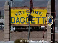
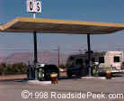
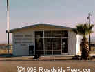
Welcome to Daggett Photo by RoadsidePeek.com
The last stretch of the California Route 66 as you head eastward begins
in Daggett. You are first greeted by an abandoned building,
origins unknown. (If you have any info regarding this building,
please drop me a line. Any info much appreciated).
Coming up the street is Mug Wumps, which
appears to be a reseller of sorts. If you need to make a stop as
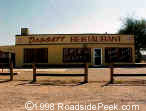
you travel through, Daggett Gas Station is available for gas tank
fill-ups and Daggett Restaurant for stomach fill-ups.
Mugwumps Photo by RoadsidePeek.com
Daggett Gas Photo by RoadsidePeek.com
Daggett Restaurant Photo by RoadsidePeek.com
Anderson's Chevron Photo by RoadsidePeek.com
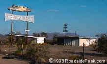
After another unknown abandoned building
is Anderson's Chevron, with petrol pumps currently surrounded by
weeds and brush. Anderson's closed around 1997.
Anderson's Chevron Photo by RoadsidePeek.com
Check out this old roadside gas station, which is known as Anderson's Chevron.
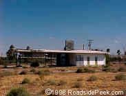
Henning Motel
Newberry Springs, CA Photo by RoadsidePeek.com
Here's the Henning Motel, standing off of Route 66 in Newberry Springs just across the street from the Bagdad Cafe. The place has been used for many a movie.
Across the street from this old petrol pump is Newberry Market, an unforgettable place to stop and freshen up.
As you travels towards the eastern edge
of Daggett, a bright red building named The Barn looms up.
Stop by if you're ready for some cocktails and dancing or if you just
want to shoot some pool or throw darts. Tired from your late night
out on the town, stop for the night at the Henning Motel.
Many thanks to Mike Lepker for identifying Anderson's Chevrolet and providing info.
The Bagdad Cafe Photo by RoadsidePeek.com
The next stretch in your travels is the Newberry,
Bagdad Route 66 run, a nice stretch of straightaway highway. Before
you get too far, check into the Bagdad Cafe, the site of the movie
of the same name. Although the real Bagdad cafe is further up the
road, this site is full of good stories. Just a hundred yards up
the street is an old auto garage called Tony's Gas pumps in decent condition still stand guard over a fading building. Traveling
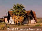
out of this area, you'll encounter the Bagdad Hut, a building with
a definite Polynesian look to it.
Tony's Auto Garage Photo by RoadsidePeek.com
Tony's pumps Photo by RoadsidePeek.com
Bagdad Hut Photo by RoadsidePeek.com
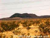
Pisgah Crater Photo by RoadsidePeek.com
The next town you'll encounter is Ludlow.
But before you can reach Ludlow, you'll see the Pisgah Crater on
the right side of the street. This volcanic looking dune is easy
to mistake for the Amboy Crater, so be careful.
Ludlow Motel Photo by RoadsidePeek.com
Ludlow is a town that contains a new section still
bustling with activity as well as an old area full of nostalgia.
Entering Ludlow, you first pass a Dairy Queen, duck under Hwy-40,
and run straight into the newer area. Located here is Ludlow
Motel, a garage, and a Coffee Shop.
Dairy
Queen Photo by RoadsidePeek.com
Ludlow
Coffee Shop Photo by RoadsidePeek.com
Garage Photo by RoadsidePeek.com
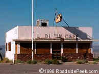
Old Ludlow Cafe, Ludlow Photo by RoadsidePeek.com
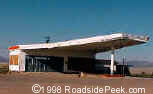
A hundred feet further down the road is the old section
of Ludlow, including an old garage, an old gas station,
and the original Ludlow Cafe.
The Ludlow Cafe still features its block letter out front, though some are starting to be missing. The windows are boarded up now. Needless to say, it's been quite a long time since the cafe last served its last meal. Here's to the memories of the Ludlow Cafe. Any chance for a reopening?
Old Garage
Ludlow, CA Photo by RoadsidePeek.com
Old Gas Station
Ludlow, CA Photo by RoadsidePeek.com
Next on the trip, Amboy.
Amboy Crater Sign Photo by RoadsidePeek.com
The trip towards the
town of Amboy is full of fun and surprises, not the least of which
is the Amboy Crater stopping point. Legend has it that
the Amboy Crater (once an active volcanic area) was used in a practical
joke many years ago that eventually evacuated the entire town of Amboy.
Amboy Crater
Amboy, CA Photo by RoadsidePeek.com
Take a look at the
road when you stop here for the crater, as in it are memories
of many a traveler. Meanwhile, take a peek at the
trains as they whiz past.
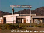
Roy's Motel Photo by RoadsidePeek.com
When you reach the town of Amboy,
you are greeted by one of the most photographed signs and structures
around, Roy's Motel and Cafe. The familiar astro-googie
signage and modernistic buildings invite travelers in for some gas,
food, and lodging.
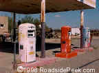
Googie Gas Station Photo by RoadsidePeek.com
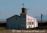
The Amboy School is right next door, currently out of session, and presumably out of
session for some time to come. Nearby is the Amboy Church and Post Office.
Amboy School Photo by RoadsidePeek.com
Amboy Church Photo by RoadsidePeek.com
Post Office Photo by RoadsidePeek.com
Road Runner's Retreat Restaurant Photo by RoadsidePeek.com
The last leg of the Eastern
California journey takes you to the town of Needles. Along the
way on the Mother Road, check out the old and shut down Road Runner's Retreat
Restaurant. This restaurant appears to have been quite a
stop in its heyday, if the immensity of the roadside marquee means
anything.
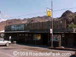
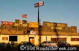
In Needles, the Wagon Wheel Restaurant is a great stop for a bite to eat or to do some souvenir shopping.
Another place for food is Hui's Restaurant (formerly Denny's)
up near the bend of the road. Best Chalet Inn is right
next door to Hui's in case you overeat and need to quit for the night.
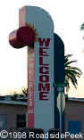
Needles Welcome Sign
Needles, CA Photo by RoadsidePeek.com
When you see the Needles Welcome sign, you know you're in for a treat. If not a treat, you know you're in for the heat. Especially if its summer.
Hui's Restaurant Photo by RoadsidePeek.com
Wagon Wheel Restaurant Photo by RoadsidePeek.com
Best Chalet Inn Photo by RoadsidePeek.com
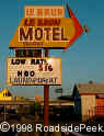
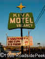
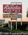
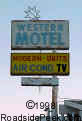
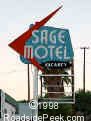
More sleeping quarters beckon to the weary travel
as you reach the end of Needles. Motels along this pike include
the , Le Brun Motel, Kiva Motel, , El Rancho Motel, Western Motel, and the Sage Motel.
(Update! The Kiva Motel is now a Budget
Inn - Mike Lepker)
Le Brun Motel Photo by RoadsidePeek.com
Kiva Motel Photo by RoadsidePeek.com
El Rancho Motel Photo by RoadsidePeek.com
Western Motel Photo by RoadsidePeek.com
Sage Motel Photo by RoadsidePeek.com
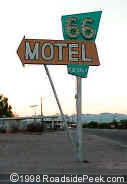
66 Motel
Needles, CA
Photo by RoadsidePeek.com
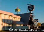
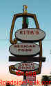
Found at the far edge
of Needles is the 66 Motel. Car trouble? West
Point Towing offers service and a keen astro-looking building
structure. Hungry? Grab some Mexican food at Rita's and sneak a peek at its unique signage.
Rita's Mexican Food
Needles, CA Photo by RoadsidePeek.com
West Point Towing
Needles, CA Photo by RoadsidePeek.com
Here's the space age gas station called West Point Towing. This gas station still maintains its googie fins, supporting the overhang.


 Welcome to Daggett
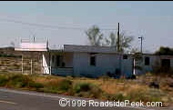 The last stretch of the California Route 66 as you head eastward begins
in Daggett. You are first greeted by an abandoned building,
origins unknown. (If you have any info regarding this building,
please drop me a line. Any info much appreciated).
The last stretch of the California Route 66 as you head eastward begins
in Daggett. You are first greeted by an abandoned building,
origins unknown. (If you have any info regarding this building,
please drop me a line. Any info much appreciated).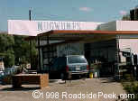
 Anderson's Chevron
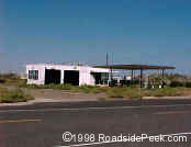 Anderson's Chevron
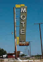
 Across the street from this old petrol pump is Newberry Market, an unforgettable place to stop and freshen up.
As you travels towards the eastern edge
of Daggett, a bright red building named The Barn looms up.
Across the street from this old petrol pump is Newberry Market, an unforgettable place to stop and freshen up.
As you travels towards the eastern edge
of Daggett, a bright red building named The Barn looms up. 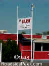 Stop by if you're ready for some cocktails and dancing or if you just
want to shoot some pool or throw darts. Tired from your late night
out on the town, stop for the night at the Henning Motel.
Stop by if you're ready for some cocktails and dancing or if you just
want to shoot some pool or throw darts. Tired from your late night
out on the town, stop for the night at the Henning Motel.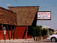 The Bagdad Cafe
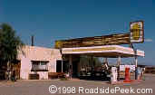
 Pisgah Crater
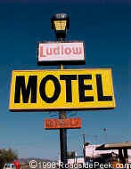 The next town you'll encounter is Ludlow.
But before you can reach Ludlow, you'll see the Pisgah Crater on
the right side of the street. This volcanic looking dune is easy
to mistake for the Amboy Crater, so be careful.
The next town you'll encounter is Ludlow.
But before you can reach Ludlow, you'll see the Pisgah Crater on
the right side of the street. This volcanic looking dune is easy
to mistake for the Amboy Crater, so be careful. 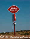
 Old Ludlow Cafe, Ludlow
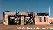
 Old Garage
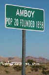 Amboy Crater Sign
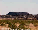 The trip towards the
town of Amboy is full of fun and surprises, not the least of which
is the Amboy Crater stopping point. Legend has it that
the Amboy Crater (once an active volcanic area) was used in a practical
joke many years ago that eventually evacuated the entire town of Amboy.
The trip towards the
town of Amboy is full of fun and surprises, not the least of which
is the Amboy Crater stopping point. Legend has it that
the Amboy Crater (once an active volcanic area) was used in a practical
joke many years ago that eventually evacuated the entire town of Amboy.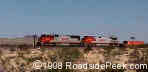
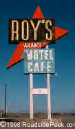
 When you reach the town of Amboy,
you are greeted by one of the most photographed signs and structures
around, Roy's Motel and Cafe. The familiar astro-googie
signage and modernistic buildings invite travelers in for some gas,
food, and lodging.
When you reach the town of Amboy,
you are greeted by one of the most photographed signs and structures
around, Roy's Motel and Cafe. The familiar astro-googie
signage and modernistic buildings invite travelers in for some gas,
food, and lodging.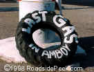
 In Needles, the Wagon Wheel Restaurant is a great stop for a bite to eat or to do some souvenir shopping.
Another place for food is Hui's Restaurant (formerly Denny's)
up near the bend of the road. Best Chalet Inn is right
next door to Hui's in case you overeat and need to quit for the night.
In Needles, the Wagon Wheel Restaurant is a great stop for a bite to eat or to do some souvenir shopping.
Another place for food is Hui's Restaurant (formerly Denny's)
up near the bend of the road. Best Chalet Inn is right
next door to Hui's in case you overeat and need to quit for the night.
 66 Motel
 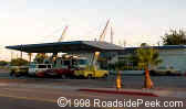 West Point Towing